Best Practices for DGNSS (Differential Global Navigation Satellite System)Systematic field procedures are part of any successful DGNSS survey that guarantees that data obtained is both accurate and reliable…Aug 31, 2024Aug 31, 2024
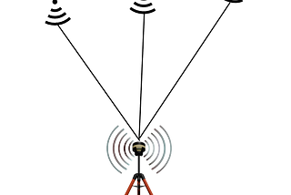
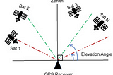
How many Satellites and Channels require in your DGNSS?In the realm of precision navigation and positioning, Differential GNSS (DGNSS) often emerges as a critical yet misunderstood technology…May 20, 2024May 20, 2024
DGNSS Series-CORS NetworkThe way we monitor locations and travel on Earth has been completely transformed by global navigation satellite systems, or GNSS. These…Feb 9, 2024Feb 9, 2024
DGNSS Series-Real Time Kinematic (RTK) and Post Processing Kinematic (PPK)Global Navigation Satellite System (GNSS) technology has transformed how we navigate and collect location-based data. Real-Time Kinematic…Feb 2, 2024Feb 2, 2024
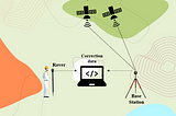
DGNSS Series-Base and RoverGlobal Navigation Satellite System (GNSS) technology has transformed how we navigate and collect geospatial data. The Base and Rover…Jan 19, 2024Jan 19, 2024
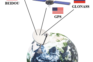
DGNSS Series-Errors in GNSSGlobal Navigation Satellite Systems (GNSS) such as GPS, GLONASS, and Galileo are critical in providing accurate location information for a…Jan 8, 2024Jan 8, 2024
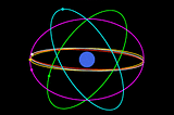
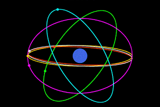
DGNSS Series- Satellite ConstellationsAt the heart of GNSS are the satellite constellations, intricate networks of orbiting satellites that work in harmony to provide precise…Dec 19, 2023Dec 19, 2023
DGNSS Series- IntroductionIn the ever-evolving landscape of technology, precision is paramount, especially when it comes to location-based services. This blog series…Dec 11, 2023Dec 11, 2023
Photogrammetry Outputs — 3D ModelIn a world where technology is always evolving, drone surveys have become the unsung heroes of data mapping and collection. Among their…Nov 21, 2023Nov 21, 2023
Photogrammetry Outputs — Point CloudThe field of surveying and mapping has changed dramatically in recent years, thanks to the introduction of drone technology and the…Nov 13, 2023Nov 13, 2023