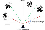
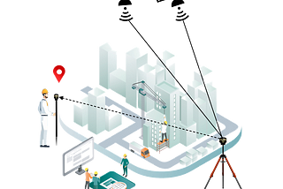
SurveygyaanHow many Satellites and Channels require in your DGNSS?In the realm of precision navigation and positioning, Differential GNSS (DGNSS) often emerges as a critical yet misunderstood technology…May 20May 20
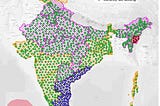
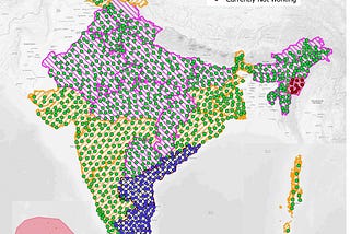
SurveygyaanDGNSS Series-CORS NetworkThe way we monitor locations and travel on Earth has been completely transformed by global navigation satellite systems, or GNSS. These…Feb 9Feb 9
SurveygyaanDGNSS Series-Real Time Kinematic (RTK) and Post Processing Kinematic (PPK)Global Navigation Satellite System (GNSS) technology has transformed how we navigate and collect location-based data. Real-Time Kinematic…Feb 21Feb 21
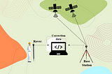
SurveygyaanDGNSS Series-Base and RoverGlobal Navigation Satellite System (GNSS) technology has transformed how we navigate and collect geospatial data. The Base and Rover…Jan 19Jan 19
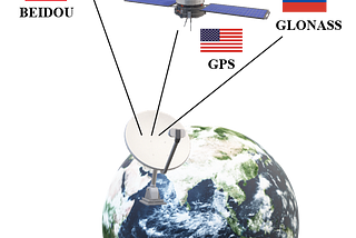
SurveygyaanDGNSS Series-Errors in GNSSGlobal Navigation Satellite Systems (GNSS) such as GPS, GLONASS, and Galileo are critical in providing accurate location information for a…Jan 8Jan 8
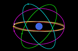
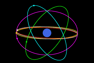
SurveygyaanDGNSS Series- Satellite ConstellationsAt the heart of GNSS are the satellite constellations, intricate networks of orbiting satellites that work in harmony to provide precise…Dec 19, 2023Dec 19, 2023
SurveygyaanDGNSS Series- IntroductionIn the ever-evolving landscape of technology, precision is paramount, especially when it comes to location-based services. This blog series…Dec 11, 2023Dec 11, 2023
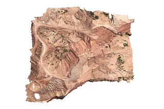
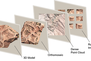
SurveygyaanPhotogrammetry Outputs — 3D ModelIn a world where technology is always evolving, drone surveys have become the unsung heroes of data mapping and collection. Among their…Nov 21, 2023Nov 21, 2023
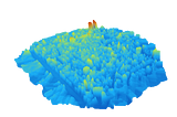
SurveygyaanPhotogrammetry Outputs — Point CloudThe field of surveying and mapping has changed dramatically in recent years, thanks to the introduction of drone technology and the…Nov 13, 2023Nov 13, 2023
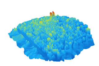
SurveygyaanPhotogrammetry Outputs — Digital Elevation ModelDigital Elevation Models (DEMs) have become vital tools for a range of applications in the fast evolving field of remote sensing and…Nov 5, 2023Nov 5, 2023